Get Best Electronics Items
Lowest Price
$59

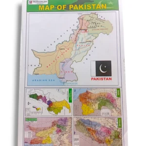
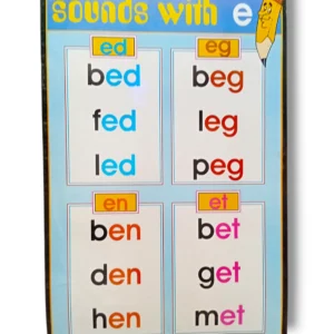
Map of Pakistan Chart – Educational Geography & Learning Poster
The Map of Pakistan Chart helps students learn about Pakistan’s provinces, major cities, rivers, and landmarks through clear visuals. Perfect for classrooms, homeschooling, and early geography education.
- Estimated Delivery : Up to 4 business days
- Free Shipping & Returns : On all orders over Rs 3000
Explore Pakistan with the Map of Pakistan Chart
The Map of Pakistan Chart is a vibrant educational poster designed to teach children about the geography of Pakistan. Featuring provinces, cities, rivers, mountains, and famous landmarks, this chart makes geography lessons interactive and engaging. Perfect for classrooms, libraries, and home learning, it inspires curiosity about Pakistan’s landscape, culture, and history.
Key Sections of the Chart
Provinces and Territories
-
Clearly marked provinces: Punjab, Sindh, Khyber Pakhtunkhwa, Balochistan
-
Federal territories and Islamabad highlighted
-
Distinct color coding for easy visual identification
Major Cities and Towns
-
Capitals: Islamabad, Karachi, Lahore, Peshawar, Quetta
-
Other important cities: Multan, Faisalabad, Hyderabad, Sialkot
-
Helps students understand population centers and urban geography
Rivers, Mountains, and Landmarks
-
Indus, Chenab, Ravi, Jhelum, and other major rivers
-
Famous mountains: K2, Nanga Parbat, Himalayas, Karakoram ranges
-
Landmarks: Minar-e-Pakistan, Badshahi Mosque, Faisal Mosque, Mazar-e-Quaid
Educational Benefits
The Map of Pakistan Chart helps students:
-
Learn geography visually with clear maps and labels
-
Identify provinces, cities, rivers, and landmarks
-
Develop spatial awareness and map-reading skills
-
Connect geography with history, culture, and environment
High-Quality Visual Learning Aid
-
Bright, realistic map illustrations for easy recognition
-
Clear labeling for provinces, rivers, mountains, and cities
-
Laminated, durable material for long-term classroom use
-
Attractive design suitable for walls, study rooms, and learning centers
Usage Ideas and Practical Applications
-
Classrooms: Geography lessons, Pakistan studies corners
-
Home Learning: Study rooms for early learners
-
Tuition Centers: Support interactive geography lessons
-
Libraries & Activity Rooms: Adds educational value to learning environments
Quality & Durability
Printed on premium laminated paper, the Map of Pakistan Chart is long-lasting, easy to clean, and resistant to wear. Its bright colors and clear visuals ensure consistent engagement for young learners.
Conclusion
The Map of Pakistan Chart is an essential educational resource for teaching children about Pakistan’s geography. Its detailed map, labeled cities, rivers, and landmarks make learning interactive and informative.
Bring the geography of Pakistan to life in your classroom or home today with this educational chart!

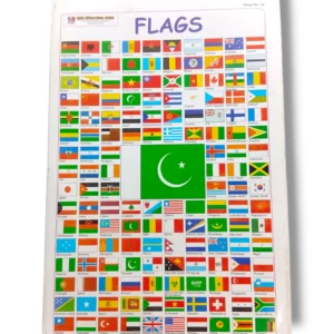 Flags Chart 54 – Educational World Flags Chart for Classroom & Kids Learning